


Storm Goretti not over yet as weather warnings issued across entire UK

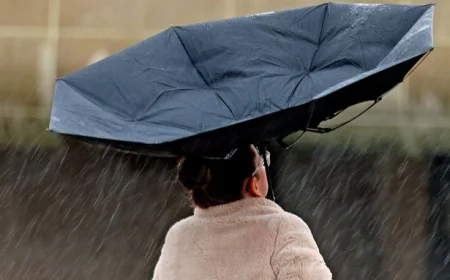
New yellow weather warnings have been issued for this weekend across the UK as Storm Goretti continues to affect weather throughout the country. This week the Met Office has issued multiple weather warnings for Wales and the rest of the UK for snow, ice, rain and wind.
Snow and ice warnings remain for most of the UK today, Friday, January 9, that will continue on Saturday and Sunday in parts. A 24-hour yellow ice warning has been issued for Wales as the Met Office warns of partially thawed snow refreezing, accompanied by freezing fog and wintry showers.
Four yellow weather warnings will be in force across most of the UK and Northern Ireland from Friday until Sunday as continuing cold temperatures bring snow and ice.
The alert has been declared from 12pm today until 12pm on Saturday for the majority of Wales and parts of England.
The Met Office forecast for the yellow warning states: "Partially thawed snow during Friday will likely freeze overnight as temperatures fall below freezing, leading to a widespread ice risk. In addition, wintry showers will continue to feed into parts of Wales at times, perhaps also into the West Midlands.
"Whilst there is some uncertainty as to the extent of any precipitation, this falling onto frozen surfaces may also add to the risk of ice. Freezing fog patches are also likely in places, posing an additional ice hazard."
Regions affected by the yellow warning include:
East Midlands
- Derby
- Derbyshire
- Leicester
- Leicestershire
- Lincolnshire
- Northamptonshire
- Nottingham
- Nottinghamshire
- Rutland
- London & South East England
- Oxfordshire
North West England
- Cheshire East
- Cheshire West and Chester
- Greater Manchester
- Lancashire
- South West England
- Bath and North East Somerset
- Bristol
- Gloucestershire
- North Somerset
- Somerset
- South Gloucestershire
- Wiltshire
Wales
- Blaenau Gwent
- Bridgend
- Caerphilly
- Cardiff
- Carmarthenshire
- Ceredigion
- Conwy
- Denbighshire
- Flintshire
- Gwynedd
- Merthyr Tydfil
- Monmouthshire
- Neath Port Talbot
- Newport
- Powys
- Rhondda Cynon Taf
- Torfaen
- Vale of Glamorgan
- Wrexham
West Midlands
- Herefordshire
- Shropshire
- Staffordshire
- Stoke-on-Trent
- Telford and Wrekin
- Warwickshire
- West Midlands Conurbation
- Worcestershire
- Yorkshire & Humber
- South Yorkshire
- West Yorkshire
The entirety of Northern Ireland has been issued with a yellow weather warning for snow and ice from 5pm this evening until 11am tomorrow morning. The forecaster predicts that there will be icy patches and some hill snow Friday night and on Saturday morning.
A third yellow warning for snow and ice has been issued for for this weekend from Friday into Saturday for Scotland and England. The alert will last from 12pm today until 3pm on Saturday.
The Met Office forecast states: "Whilst not all areas will be affected, scattered wintry showers will continue to feed inland from the North Sea through Friday afternoon, evening and overnight into Saturday morning. These are likely to give some snow accumulations in places, more especially on hills above 100m elevation where 2-5 cm will be possible. As much as 10-15 cm could accumulate on hills above 300m elevation in parts of central and/or eastern Scotland.
"Ice will be a more widespread hazard, especially overnight as temperatures fall widely below freezing, particularly away from immediate windward coasts."
Snow is expected to lead to disruption in Sunday as another yellow weather warning has been issued from 2am on Sunday until 3pm across Scotland and England. Travel delays on roads with the stranding of some vehicles and passengers is expected as well as possible power cuts.
What's Your Reaction?
 Like
0
Like
0
 Dislike
0
Dislike
0
 Love
0
Love
0
 Funny
0
Funny
0
 Angry
0
Angry
0
 Sad
0
Sad
0
 Wow
0
Wow
0